Top 7 Strange Things Found On Google Maps
Kenneth Coo
Published
06/09/2016
in
wtf
What where they looking for when they found this?!?
- List View
- Player View
- Grid View
Advertisement
-
1.
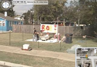
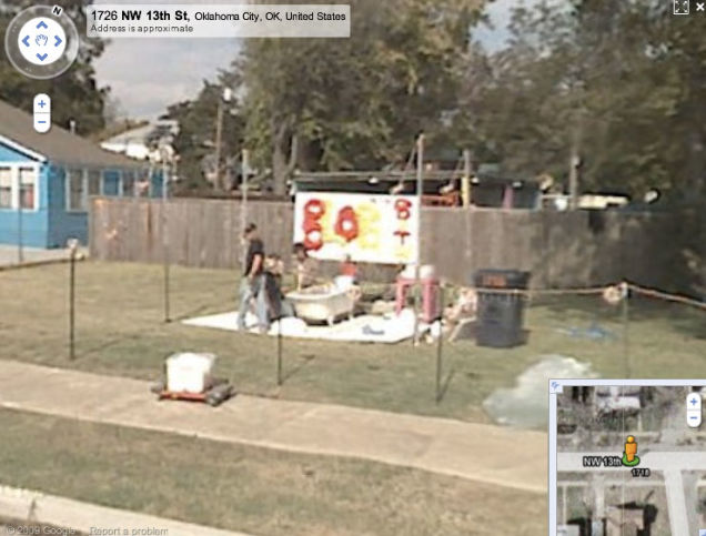 The Roadside Bathtub. Wayne Coyne has proven to be quite the eccentric. The member on an alternative indie band knew he had to make something special when he found out the Google Car will come down his street; He planned accordingly - hopping into the tub at just the right moment for this odd photograph.
 -
2.
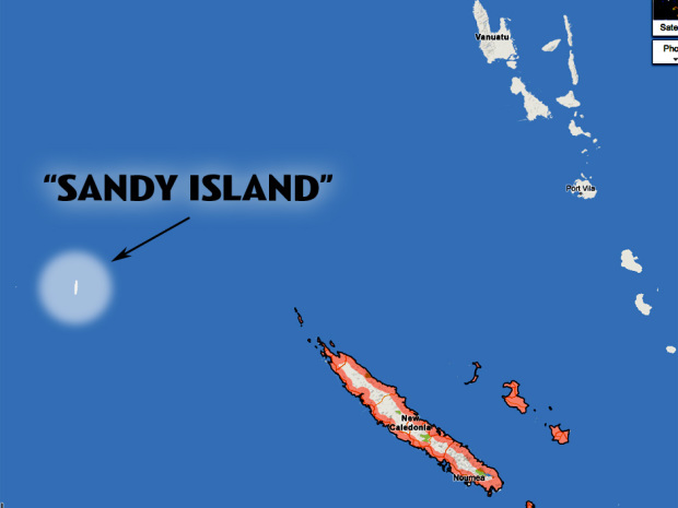 Sandy Island. "Sandy Island", a nonexistent island appearing on maps near the northwest of New Caledonia, has stumped cartographers for over a century. After appearing on maps for 100 years as a "phantom location", this strange location was finally photographed by Google Earth - simply displaying a black polygonal void, about the size of Manhattan. The Australian researchers who found the black mass alerted scientists - eventually sailing to the location in 2012 only to find open water and emptiness instead of the solid ground they expected. Now thought to simply be human error or possibly just a pumice raft - it's hard not to suspect that Google may actually be in on the joke.
 -
3.
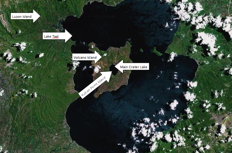 The Lake Inside Of A Lake. Found by map enthusiasts that carefully scrub Google Earth, the world's biggest island-in-a-lake-located-ON-an-island-in-a-lake-located-on-an-island-itself was discovered near Northern Canada several years ago. This narrow, tilde-shaped strip of land - measuring only four acres in size - floats quietly in the center of a small lake that itself is encapsulated by another, larger island that resides inside a mass of finger lakes located about 75 miles from the coast of Victoria Island.
 -
4.
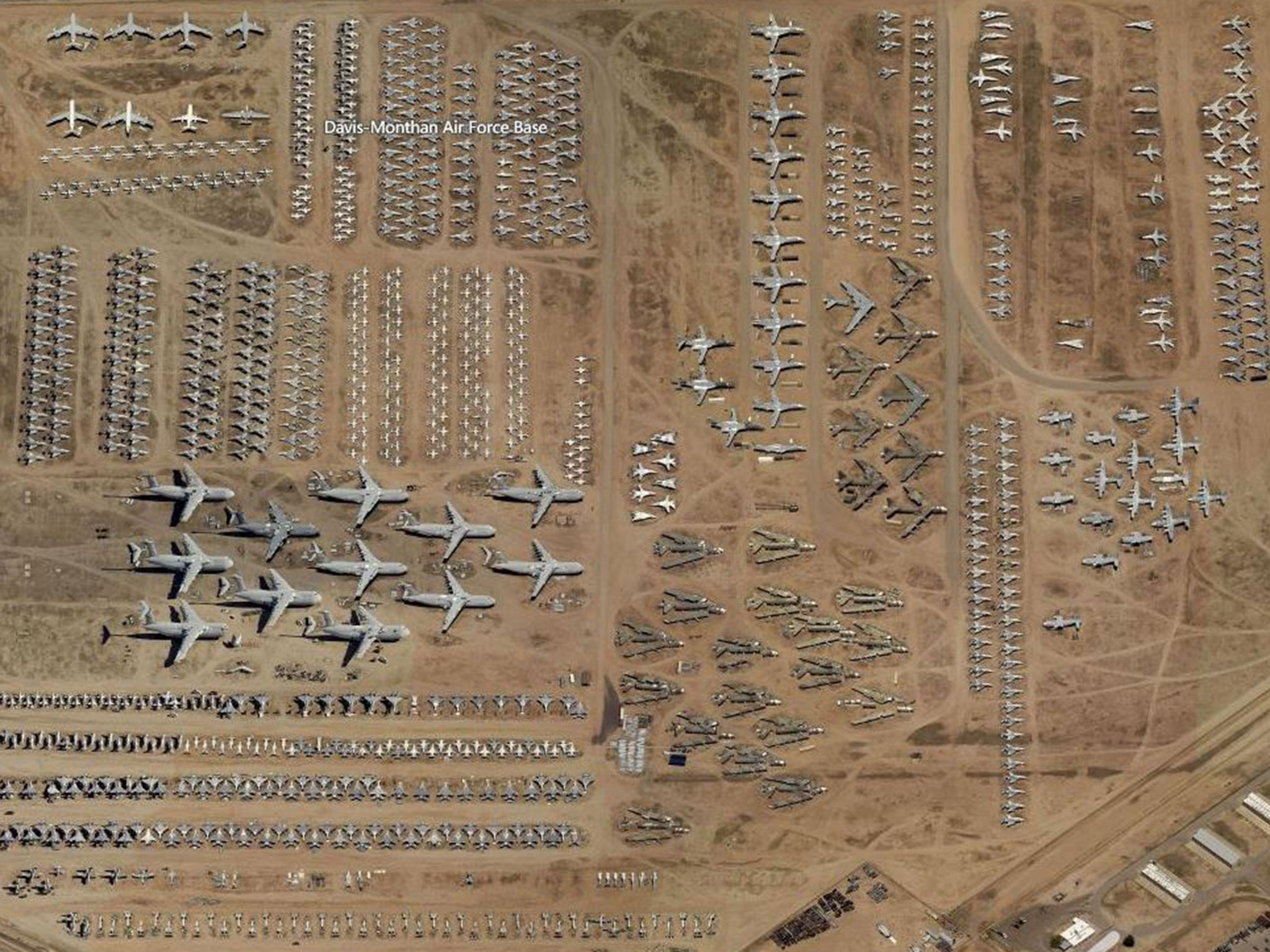 The Airplane Graveyard. The Davis Monthan Air Force Base in Tucson, Arizona (otherwise more commonly known as "The Boneyard") is a 2,600 acre metaphorical cemetery - Although closed to the general public, navigating to the coordinates on Google Earth provides a detailed peek inside - which is almost every single piece of aircraft the United States Military has flown since World War II - storing unbelievable relics of the past in staggering numbers. Snooping around the premises offers a glimpse into air travel history - albeit in a slightly creepy, definitely desolate kind of way.
 -
5.
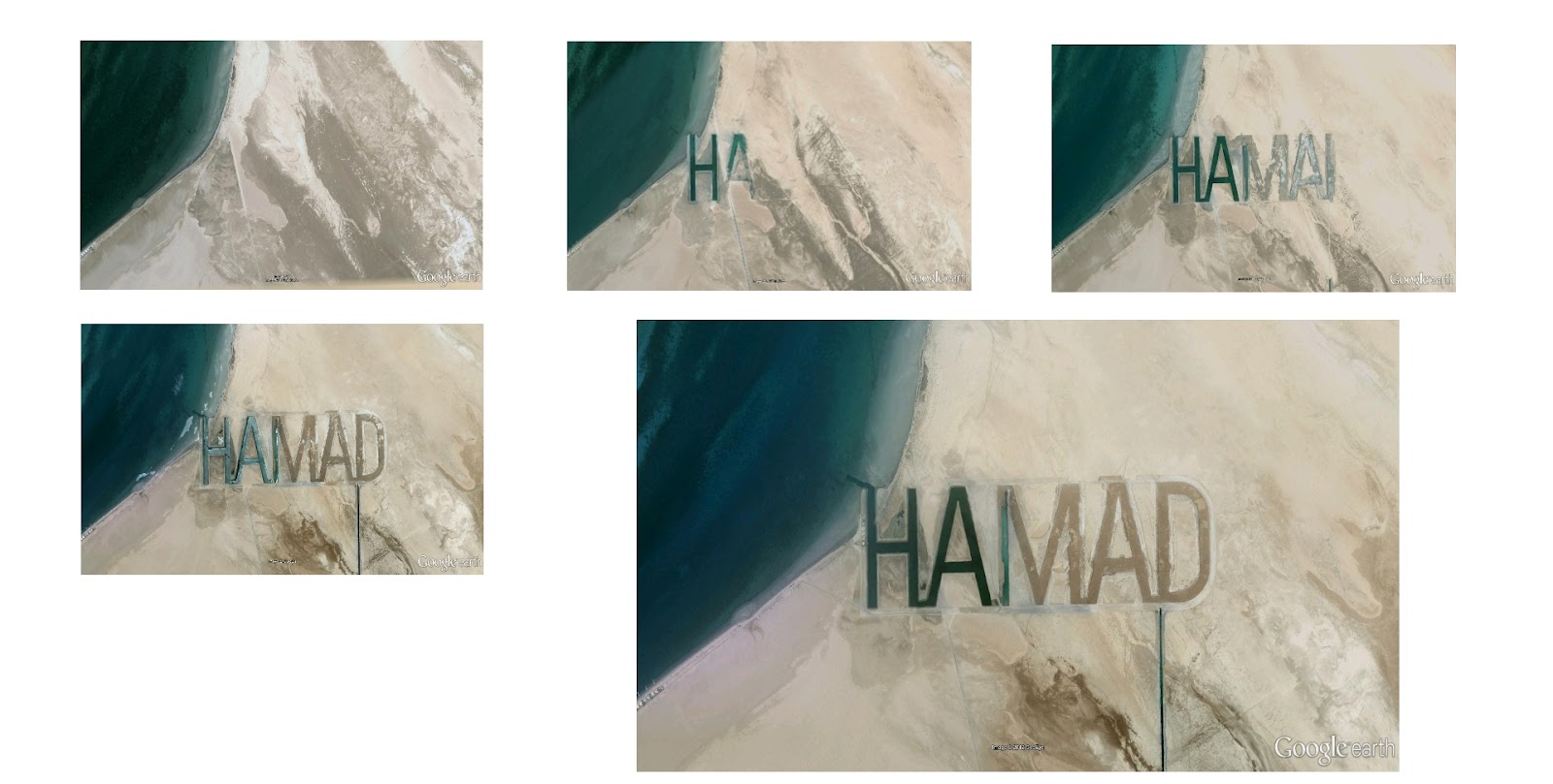 The Giant Signature. Billionaire Sheikh (and member of Abu Dhabi's ruling family) Hamad bin Hamdan al Nahyan likes to stand out. Aside from an absolutely mind-blowing amount of wealth and power, he likes to be seen (and not so much heard). Ordering to have his first name carved into the top sand layers of surface on al Futaisi Island located in the Persian Gulf (which he also happens to own). Measuring a half-mile tall by two miles wide - the letters can be visibly spotted from space and are debatably the largest man-made typography. Since the letters are so large, the pathways caused by the text being carved into the sand has formed waterways and channels, effectively making this a semi-permanent (if not altogether permanent) installation.
 -
6.
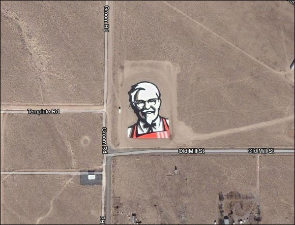 The Massive Colonel Sanders. It was only a matter of time before advertising executives realized the potential in "mapvertising" - a now common practice of constructing elaborate, enormous physical contraptions that form a logo or photo when viewed aerially. Although major companies such as Coca-Cola have constructed the world's largest Coke logo on a hillside of Chile (built out of a reported 70,000 empty bottles of the sugary soda) - KFC has outdone their peers with this 87,500 square foot picture of the chicken overlord - none other than Colonel Sanders himself - located just off the Extraterrestrial Highway in Nevada.
 -
7.
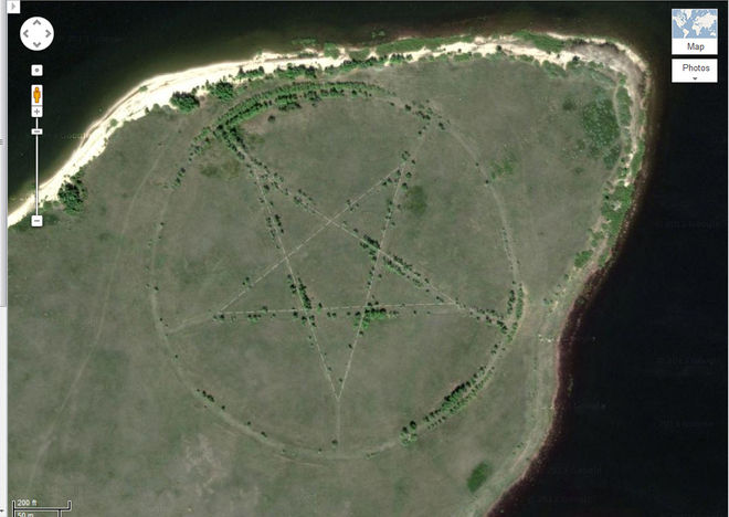 The Pentagram. Located on the windy and dusty steppes of central Asia, deep within an isolated region of Kazakhstan, this humongous pentagram measures just about 1,200 feet in diameter - deeply etched into the surface of the Earth below. Tucked away in the southern shore of the Upper Tobol Reservoir, the chilling discovery can be spotted on both Google Earth - and in greater, vivid detail on Google Maps. With the closest human habitation being over 12 miles east of the symbol - conspiracy theorists went nuts over the source of the ancient symbol. After much speculation and deliberation, it was revealed that the pentagram was initially etched into the ground due to the region's ties to Soviet Russia. Since the area is determined to be a former Soviet campground, the insignia would be marked there as stars were commonly used to decorate Soviet facades, flags and monuments.
- REPLAY GALLERY
-
- Top 7 Strange Things Found On Google Maps
- NEXT GALLERY
-

- How To Understand What The British Say To You
The Roadside Bathtub. Wayne Coyne has proven to be quite the eccentric. The member on an alternative indie band knew he had to make something special when he found out the Google Car will come down his street; He planned accordingly - hopping into the tub at just the right moment for this odd photograph.
7/7
1/7
Categories:
Wtf




1 Comments